
Filter by
SubjectRequired
LanguageRequired
The language used throughout the course, in both instruction and assessments.
Learning ProductRequired
LevelRequired
DurationRequired
SkillsRequired
SubtitlesRequired
EducatorRequired
Results for "geospatial mapping"
University of Toronto
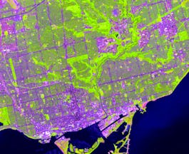
Skills you'll gain: ArcGIS, GIS Software, Spatial Data Analysis, Spatial Analysis, Geographic Information Systems, Geospatial Mapping, Geospatial Information and Technology, Data Mapping, Data Visualization, Metadata Management, Query Languages, Data Manipulation, Data Synthesis, Quantitative Research, Data Compilation, Data Processing, Typography, Data Cleansing, Data Validation, Data Storytelling
University of Toronto
Skills you'll gain: ArcGIS, GIS Software, Spatial Data Analysis, Geographic Information Systems, Geospatial Information and Technology, Geospatial Mapping, Data Mapping, Data Collection
 Status: [object Object]
Skills you'll gain: Istio, Node.JS, Software Development Life Cycle, Unit Testing, Cloud Computing Architecture, Server Side, Application Deployment, Kubernetes, React Redux, Cloud Services, Django (Web Framework), Object-Relational Mapping, OpenShift, Git (Version Control System), Full-Stack Web Development, HTML and CSS, Cloud Computing, Jupyter, Generative AI, Interviewing Skills

L&T EduTech
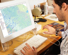
Skills you'll gain: Geospatial Information and Technology, Spatial Analysis, GIS Software, Spatial Data Analysis, Geographic Information Systems, Geospatial Mapping, Database Management, Database Management Systems, Construction Management, ArcGIS, Relational Databases, Visualization (Computer Graphics), Heat Maps, Civil and Architectural Engineering, Global Positioning Systems, Decision Support Systems, Building Information Modeling, As-Built Drawings, Survey Creation, AutoCAD Civil 3D
University of California, Davis
Skills you'll gain: ArcGIS, GIS Software, Data Sharing, Geographic Information Systems, Geospatial Mapping, Metadata Management, Data Quality, Data Mapping, File Management, Data Import/Export
University of California, Davis
Skills you'll gain: Spatial Analysis, ArcGIS, Geographic Information Systems, Geospatial Mapping, Data Quality, Data Mapping, Data Modeling, Data Storage Technologies, Data Storage, Data Processing, Data Manipulation, Databases

Skills you'll gain: Open Web Application Security Project (OWASP), Istio, Software Development Life Cycle, Linux Commands, Unit Testing, Application Deployment, Kubernetes, NoSQL, Bash (Scripting Language), MongoDB, Shell Script, Django (Web Framework), Object-Relational Mapping, OpenShift, Git (Version Control System), Cloud Applications, Containerization, GitHub, Jupyter, Grafana

L&T EduTech
Skills you'll gain: Geospatial Mapping, Geospatial Information and Technology, Geographic Information Systems, Spatial Data Analysis, Construction Management, Visualization (Computer Graphics), Civil and Architectural Engineering, Spatial Analysis, Global Positioning Systems, As-Built Drawings, Survey Creation, AutoCAD Civil 3D, Environmental Monitoring, Systems Of Measurement, 3D Modeling, Data Cleansing

University of California, Davis
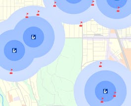
Skills you'll gain: ArcGIS, GIS Software, Spatial Analysis, Data Storytelling, Spatial Data Analysis, Geographic Information Systems, Data Presentation, Data Sharing, Geospatial Mapping, Geospatial Information and Technology, Land Management, Heat Maps, Epidemiology, Metadata Management, Data Mapping, Data Visualization Software, Data Quality, File Management, Network Analysis, Data Modeling

Johns Hopkins University
Skills you'll gain: Epidemiology, Geographic Information Systems, Data Visualization Software, GIS Software, Health Systems, System Monitoring, Infectious Diseases, Risk Analysis, Investigation, Geospatial Mapping, Health Assessment, Event Monitoring, Health Care, Biostatistics, Continuous Monitoring, Descriptive Analytics, Program Evaluation, Emergency Response, Health Information Management and Medical Records, Technical Communication
 Status: Free
Coursera Instructor Network
Skills you'll gain: Data Visualization, Data-Driven Decision-Making, Data Visualization Software, Interactive Data Visualization, Business Intelligence, Data Storytelling, Data Presentation, Dashboard

Coursera Project Network
Skills you'll gain: Canva (Software), Multimedia, Data Visualization, Marketing Design, Brainstorming, Data Sharing, Presentations, Communication
In summary, here are 10 of our most popular geospatial mapping courses
- GIS, Mapping, and Spatial Analysis: University of Toronto
- Introduction to GIS Mapping: University of Toronto
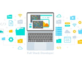
- IBM Full Stack Software Developer: IBM
- Geospatial Techniques for Engineers: L&T EduTech
- Fundamentals of GIS: University of California, Davis
- GIS Data Formats, Design and Quality: University of California, Davis
- IBM Back-End Development: IBM
- Geospatial Technology for Construction : L&T EduTech
- Geographic Information Systems (GIS): University of California, Davis
- Epidemiology in Public Health Practice: Johns Hopkins University


